
If you want a hike in Kauai that takes you off-the-beaten path to waterfalls that mostly only locals know about, this hike is for you. The Ultimate Kauai Guidebook outed this trail, calling it the “Best Hidden Gem” of the east shore, but even with this guidebook cred, the hard-to-find trailhead and entirely unmarked trail keep it quiet and relatively tourist-free. We saw more wildlife along the trail than people, including a wild boar that ran past the trail, frogs, tadpoles, a plethora of birds, lizards and fish.
The short, moderately difficult 2.2 mile hike along the Kapa’a Stream will take you up close to two waterfalls, both known as Ho’opi’i Falls depending on who you are talking to or which map you are using. If you are directionally challenged or nervous about hiking unmarked trails, I recommend using our GPS track for reassurance or downloading the The Ultimate Kauai Guidebook iPhone app which includes a location aware map with the trail track as well. The trail is on state land, but is also near residential homes so please be conscientious and respectful of the nearby neighbors and private property along the route.
UPDATE 5/1/2016: A commenter recently reported that at least one trail to the lower falls is now closed off as it went through private land. Here’s an article about it from TheGardenIsland.com. Please obey any signage and avoid trespassing on private property.
| Distance | 2.2 miles | | | Time | 2 hours |
|---|---|---|---|---|
| Elev. Gain | 563 ft. | | | Elev. Loss | 341 ft. |
| Difficulty | Moderate [?] | | | Parking | Moderate [?] |
| Trail Signage | None | | | Bathrooms | None |
The Route
Unmarked trails along Kapa’a Stream
Trail Maps
- GPS Track: Download the GPX file
The Route In Detail:
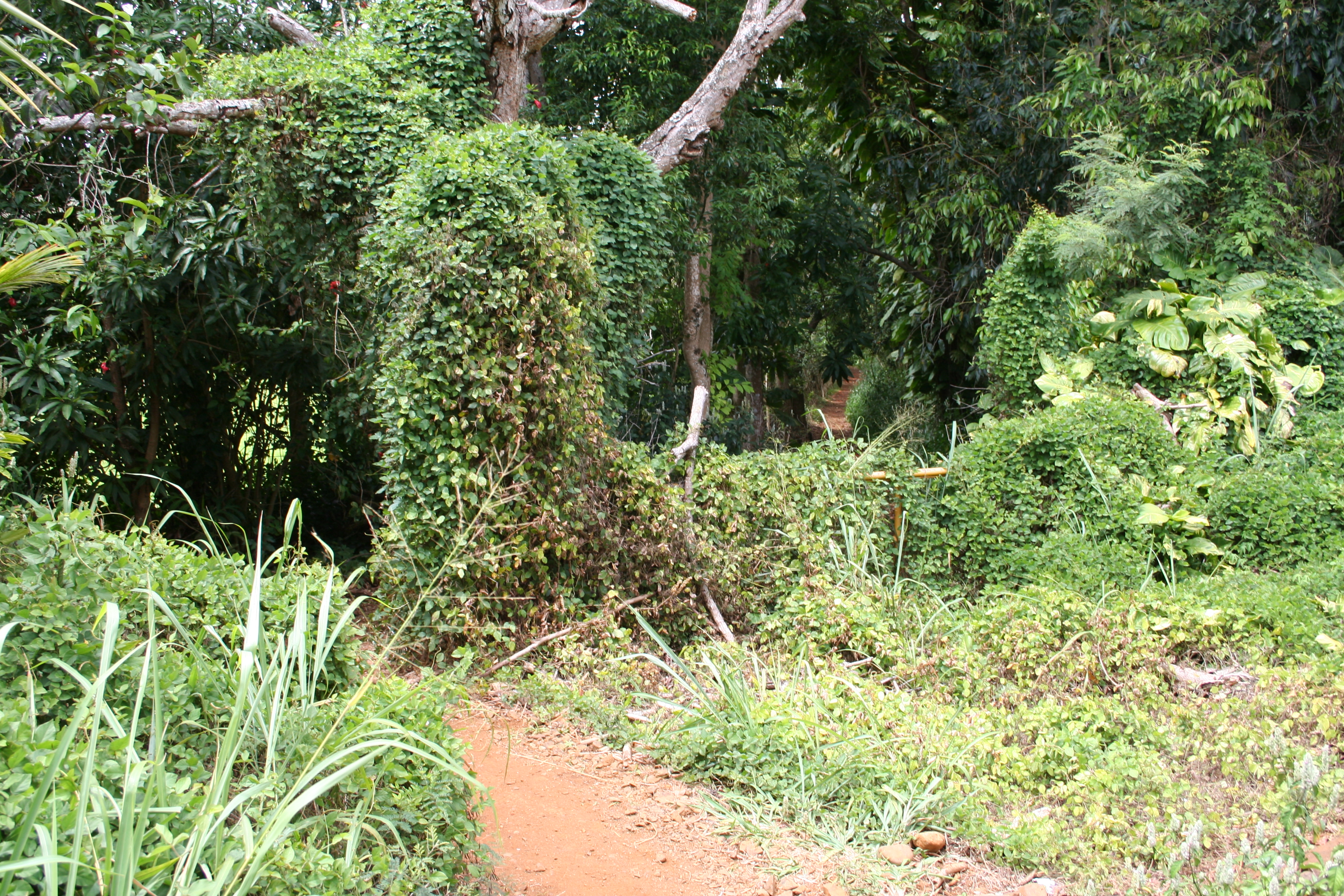
1. The trail begins at what the Ultimate Kauai Guidebook calls an “old public dirt road.” Don’t let this description fool you; it’s not like any road on the mainland. See this photo to see what it looks like so you know what you are looking for. An old metal gate in front of the “road” is completely overgrown and once you walk past that it’s hard to believe this used to be a road.
2. Follow the road down a steep slippery-when-wet hill for the first quarter mile or so. Hiking poles will be useful if you have them.
3. When the trail levels off a little you’ll see several fairly large/distinct trail options that turn toward the left and go down toward Kapa’a Stream. From what we could tell, all of them lead to roughly the same single track hiking path, so take whichever one suits your fancy. This should take you to your first up close look at the Kapa’a Stream.
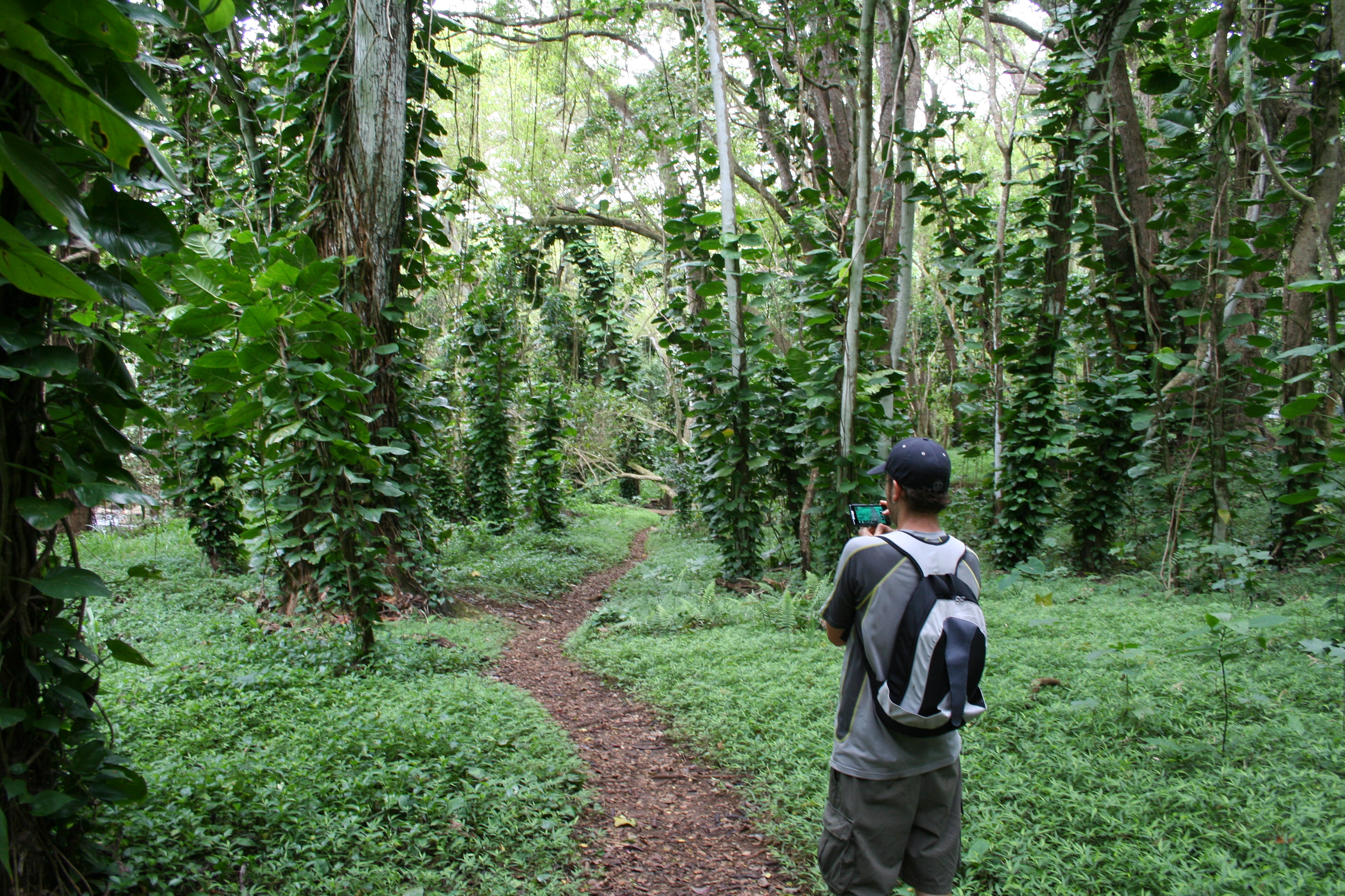
4. Follow the smaller single track trail along the stream.
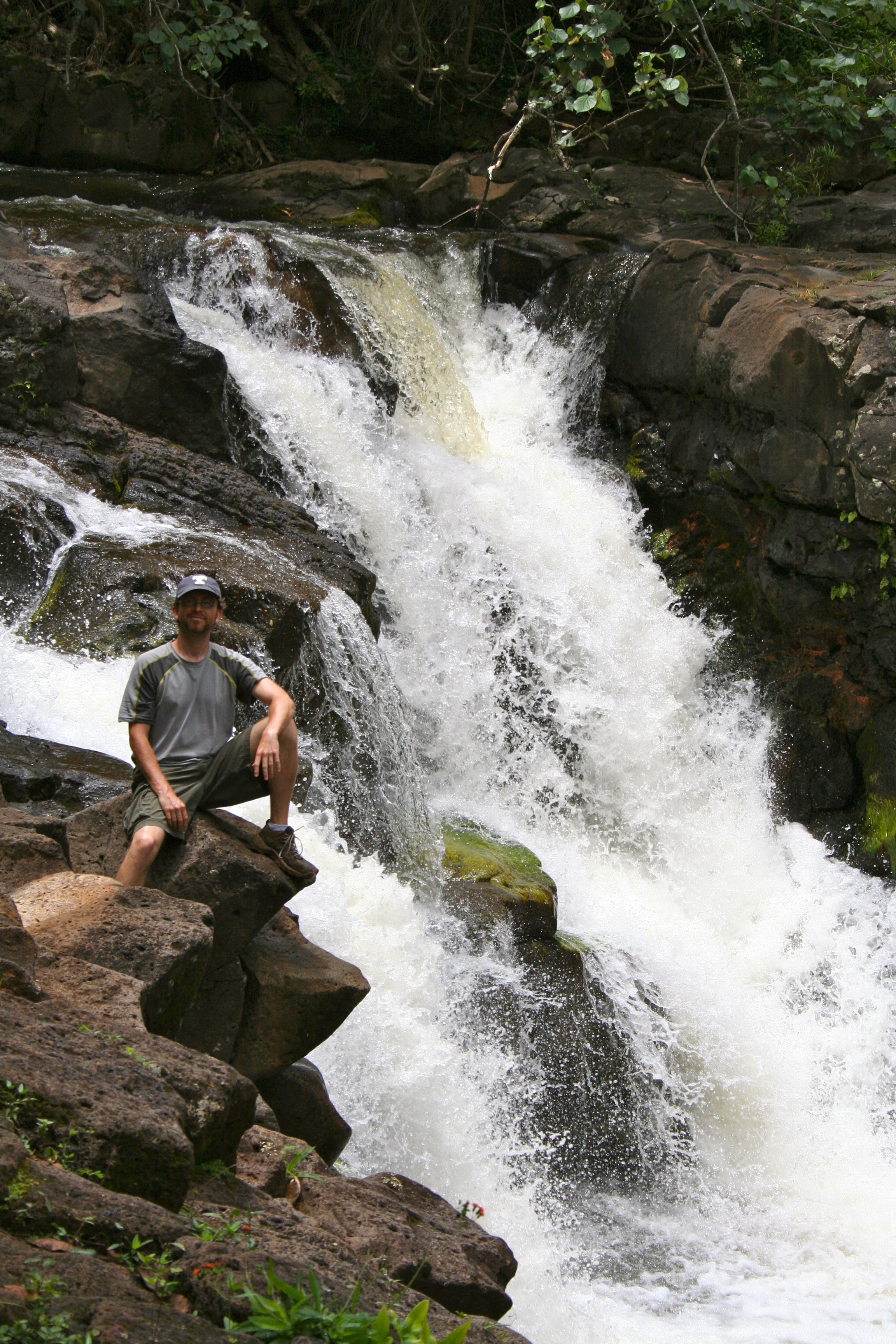
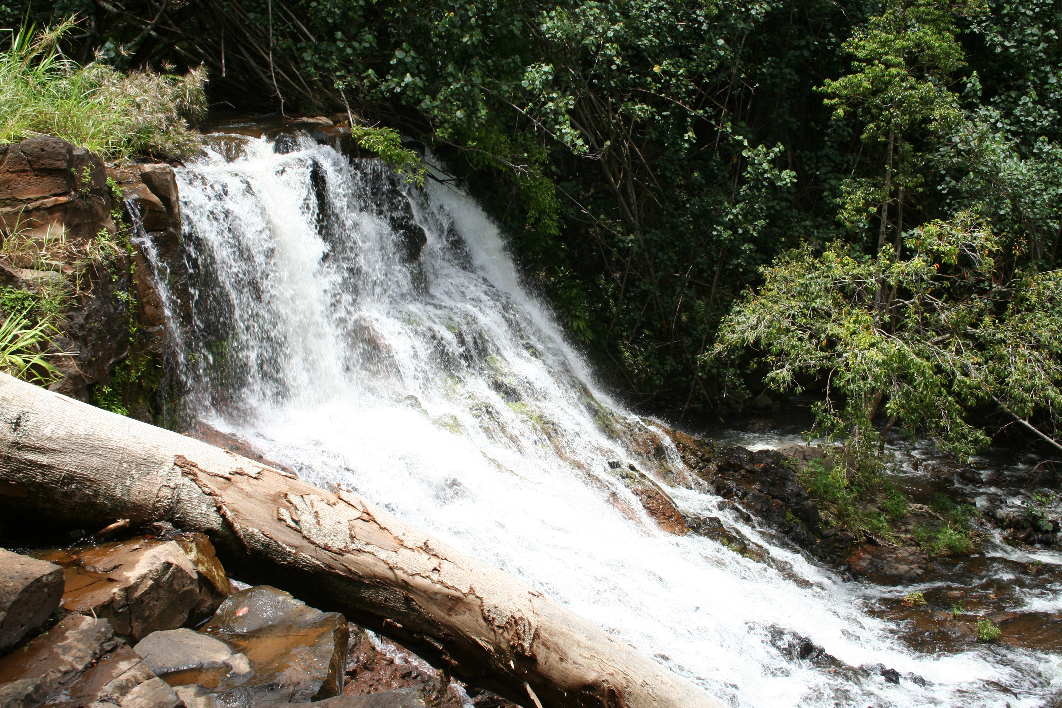
5. You’ll hear the Upper Ho’opi’i Waterfall before you see it. There were several tracks to the left leading down the muddy, slippery slope toward the falls. We took the second of them, but I think any would work; you may just have to walk a little along the stream to get the falls itself if you don’t take the one that leads right to it.
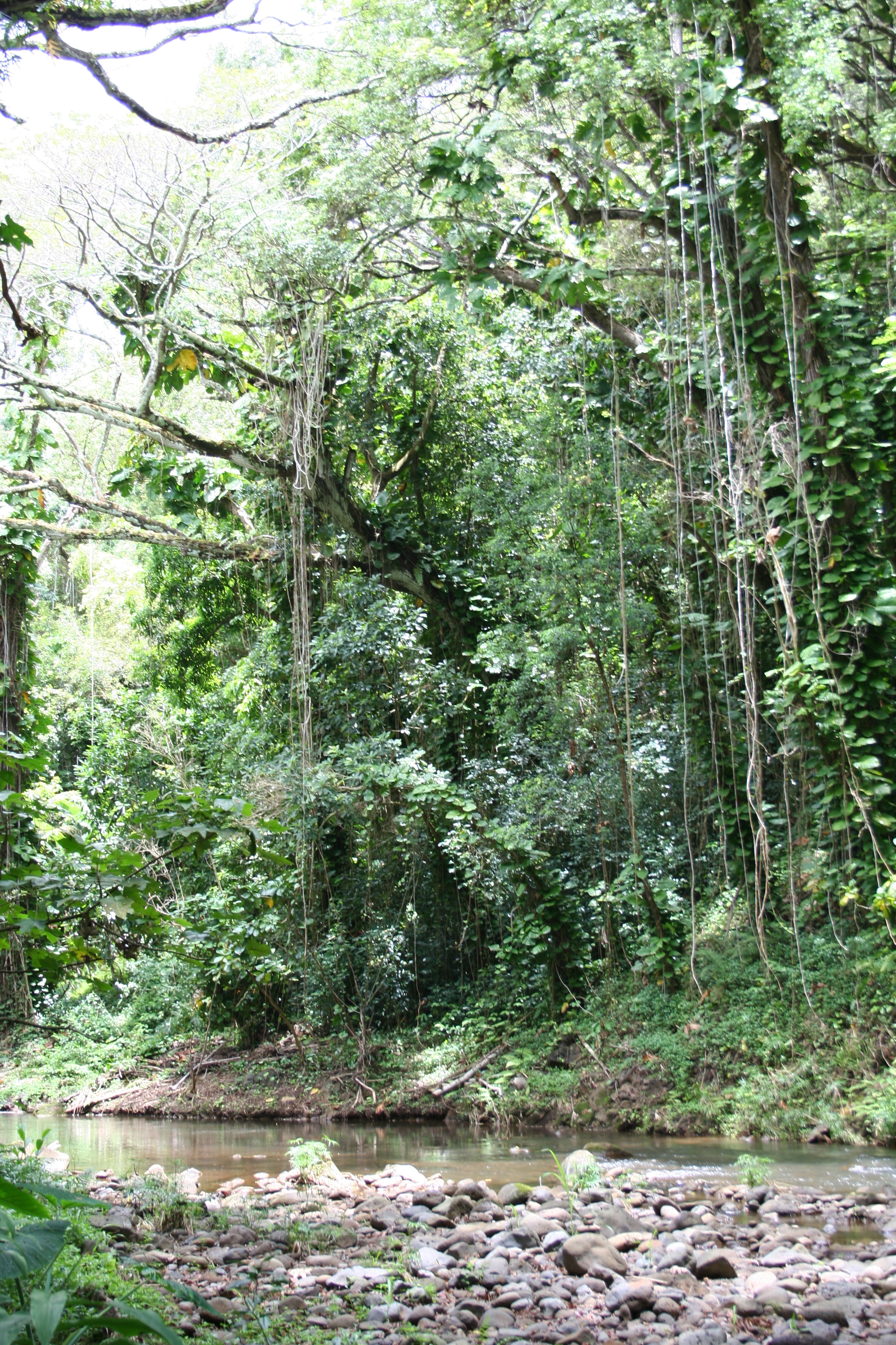
6. After enjoying the first of the falls, backtrack up the hill to the single track trail you left earlier and continue following in the direction of the stream. The trail will meander a little more inland into a densely wooded area where either side of the trail is a tangle of intertwined branches and roots. [Photo]
7. Shortly after this dense grove begins to open up, you’ll have a directional choice: Wider path curving to the right away from the stream or smaller single track to the left/ahead of you. Take the left route, which will bring you back near the stream edge.
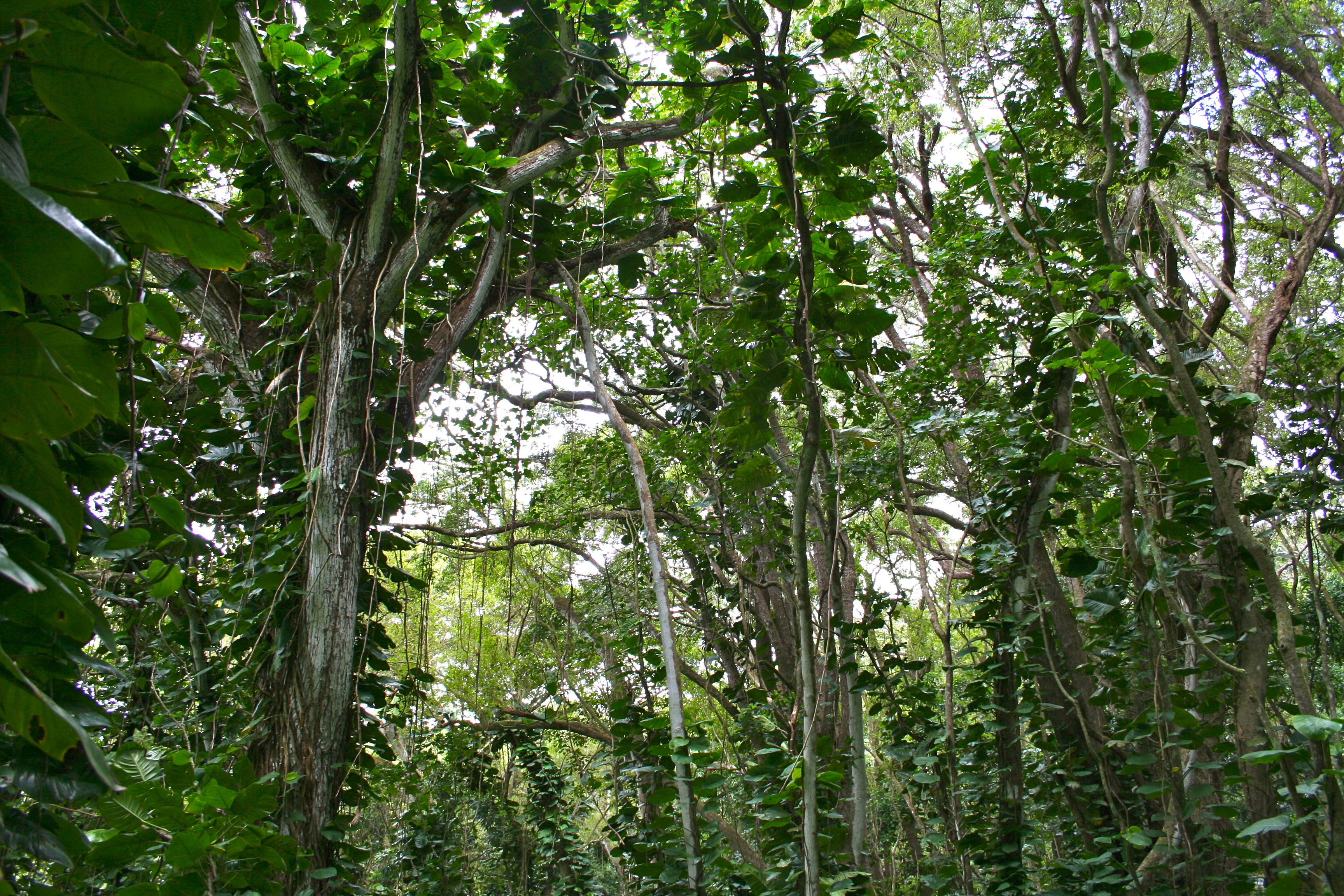
8. At this point you’ll be in a forest of trees covered in philodendron vines with a fairly easy to see trail [Photo].
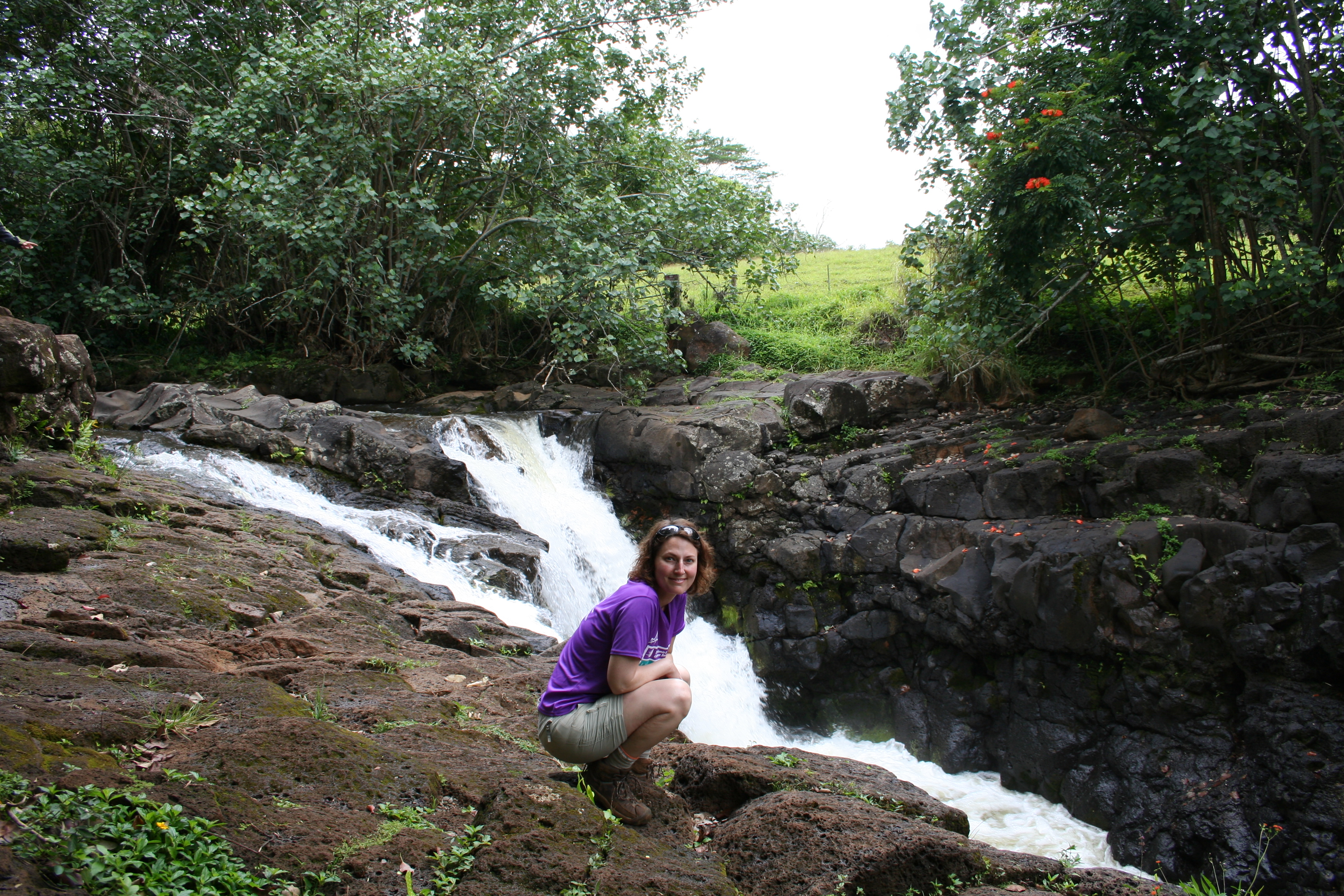
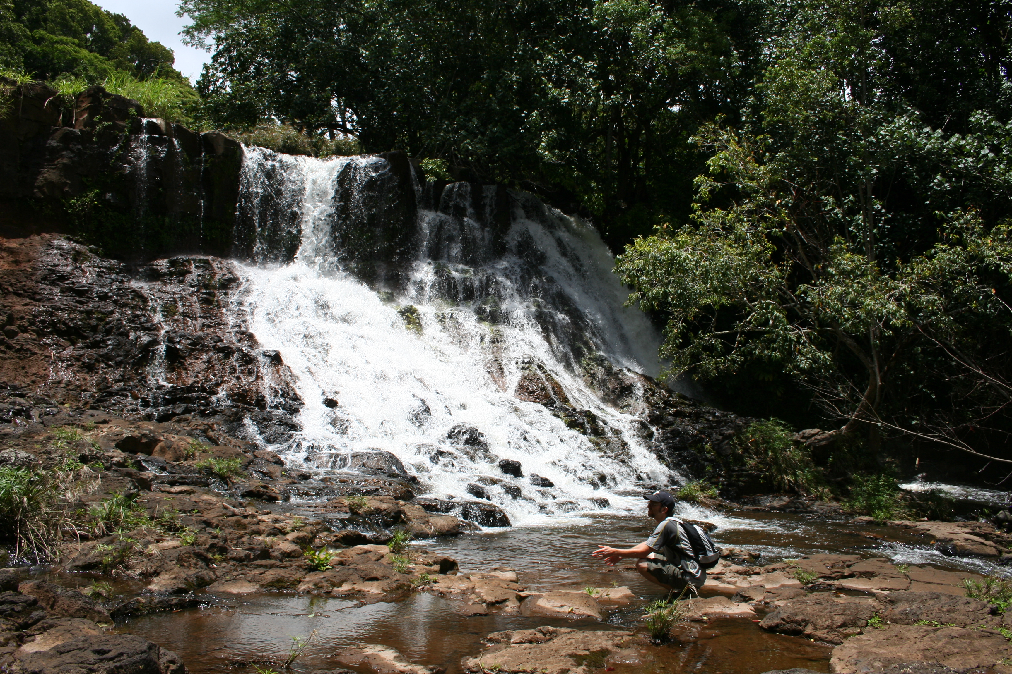
The trail will come to a T shortly. If you take it to the left, you will come out at the top of the Lower Ho’opi’i Falls with no safe means to get down them, but still a nice place to take in a view. If you go to the right, you’ll head uphill again past the falls where you will get an option on your left to follow a steep, slippery trail down to come out at the bottom of the falls. I recommend giving them both a go; it’s a short hike and you have time to explore a little. Just watch your step on all the slick slopes.
Note: The trail does continue beyond where you go down to the Lower Ho’opi’i Falls. So the turn off to head down isn’t at any “end” to the path you are on.
9. Return the way you came.
Photos

Trail Notes & Tips
Difficulty
While the trail is short, it isn’t easy for two reasons: navigation and terrain.
Navigation
You won’t have trail signs to help you, nor will you have a well maintained path for much of this hike. In places it may be barely a single track, in others you may have a few options to choose from. It’s worth knowing that you will never cross the stream but for the most part, you will be following it. As mentioned in the trail description above, there is one part through some dense forest that comes inland from the stream but other than that, you’ll nearly always be following close to the stream’s edge.
For peace of mind, I recommend using our GPS track for reassurance or downloading the The Ultimate Kauai Guidebook iPhone app which includes a location aware map with the trail track as well.
Terrain
This isn’t a well-maintained park trail. There are some very steep, slippery parts, especially as you are trying to scramble down to either of the falls. Take your time and don’t go anywhere you don’t feel comfortable climbing back out of.
Trail Tip: Bring bug spray
Of all the hikes I’ve done on Kauai, this was the only one where bug spray was an absolute must. The mosquitoes near the falls were blood-thirsty and prolific.
Getting There
Directions
Here is an approximate Google Map of the trailhead.
From Kapa’a
- Near mile marker 9 on Highway 56 (the main road) through Kapa’a, turn inland on Kawaihau Road
- Take a right at Kapahi Road
- The unmarked trailhead will be on your left. [Photo of what it looks like]
Parking
There’s room for two, maybe three, cars on the shoulder of the road beside the trailhead. This is a residential area, so be cognizant of the homeowners if you need to park elsewhere on the street.


Perfect instructions and great photos. We hiked it this morning, thanks!
Dave & Angela: Glad you enjoyed the hike and the description was helpful. Hope you have a great rest of your stay in Kauai!
Just did the hike today great tips and directions wonderful waterfalls
Found the trailhead, just as you described! Thanks for such detailed directions! A great hike!
Glad you enjoyed it! And thanks for the tweet @yuppietraveler 🙂
[…] a problem for us during our visit to the falls, however, if you go on a drier day then you might have an issue. Bring along some mosquito repellent just in […]
Thanks for the great description and gps track. I liked this much more than the Blue Book description. The gate is now painted red & gray and is very easy to follow. There were alot of people on the trail the day we went, even looked like a guide taking a family. Also lots of children, so not too difficult for kids – just watch the slippery spots and the steep treks down to the falls.
Another alternate way to get to the upper falls is to hike directly on the rocky area on the right edge of the stream (with the stream to your left and the trails uphill to your right). This may depend on the water level though (would be dangerous if the water flow is heavy), as there are a few parts where you may have to step right into the stream if you’re not flexible/tall enough to perfectly traverse the rocky bank. Also I’d like to mention (since it’s not mentioned here) that the upper falls is a somewhat popular swimming area, so many people on this hike actually come to dive off the top of the upper falls into the water. It’s pretty common to see a group of people hanging out in swimwear at the upper falls. The lower falls lacks a swimmable pond at its base, so the lower falls is mainly for just picture-taking.
We just heard that Hoopii Falls is now closed. Does anyone know if that is true?
The “lower falls” is closed off, because it turns out the trail leading there is on private property. Read the full article here: http://thegardenisland.com/news/local/waterfall-on-lockdown/article_1bdca7ba-a135-572e-a858-0c65c9bc3588.html
Hiked down to the falls today and took the closed trail after hitting a dead-end on the riverbank. Didn’t realize the controversy. It’s an amazing area and I can understand why the leaseholder wants to protect it.
[…] The trailhead is a bit tricky to find, so we recommend asking locals, or consulting websites like Hikerly before heading out. Once on the hike, you’ll notice many of Kauai’s celebrated […]
Hi there!!! What an amazing little gem of a spot! My family of six had an awesome time cliff jumping and playing on the other rope swing. We did notice, albeit small, something biting our toes getting out of the water. At first I thought it was my imagination and then it bit (not hard) again. My husband said the same thing! We noticed a striped black and white fish, but now I am curious what it was. It was more than just a brush of a fin…more like a nip!! It was enough to make me scream like a baby! Thoughts on what kind of fish it was!?
Thanks!
Amanda
As someone who was born and raised right in front of this trail, I need to speak up about the serious issues this hike has caused for our community. This article might make it sound like a peaceful, off-the-beaten-path gem, but what’s missing is the fact that Ho‘opi‘i Falls sits directly in a residential neighborhood — and it’s not a public hiking destination the way people assume. There is no designated parking, no bathrooms, no trash cans, no signage, and no proper trailhead. That “old public dirt road” you mentioned? That’s a narrow one-lane driveway where families live, kids play, and people walk their dogs. It is not meant to handle crowds of tourists or rental cars parked bumper to bumper, blocking access and endangering those of us who live here.
Over the years, we’ve seen this place go from a quiet, locally known spot to something that’s been completely overrun by social media posts and outdated guidebooks like the one mentioned here. People trespass through our yards, climb over fences, ignore “no parking” and “private property” signs, and treat this area like a free-for-all. They blast music, leave trash, change clothes on our lawns, and even use our hose lines or outdoor showers. We’ve had emergency vehicles blocked, accidents, and more than one fatal incident here — and still, no real enforcement or protection has been put in place for the people who live here.
So while this write-up may intend to help hikers find a cool trail, what it actually does is encourage more people to ignore the bigger problem: this place is not equipped to handle tourism traffic, and it’s actively hurting the neighborhood. At this point, most of us are no longer just frustrated — we’re organizing. We’ve filed complaints, reached out to local officials, and documented the impacts. This isn’t about being anti-tourist — it’s about basic respect.
Please stop promoting trails like this without including the real-life consequences they’re having on the communities who live there. We are not just scenery for someone’s vacation photos. If you truly care about Hawai‘i, then that includes respecting the people who call it home.
Leila Sivanathan
Leila – thank you for your comment. Disrespecting private property, the people and the environment is never OK. Period. When we were there in 2012 it was before social media and influencers and was a peaceful and nearly private walk in a wonderful place. Sounds like since then things have changed and not for the better. You are lucky to live where you are and I’m sorry to hear about all the problem “hikers” disrespecting your backyard. It makes me sad to hear your experience.
Just wanted to say I was uncertain about coming to this hike but after reading Leila’s comment was inspired to come in case people like her succeed in limiting access to these public lands.
How fortunate to live in such a beautiful place and visit any time you would like!
We live in the time of Google. All of my favorite “secret” hikes, campgrounds, beaches where I grew up are well publicized on the internet now. That’s a bit of a bummer, but that’s life. There are people like you where I live who try to close off access to hikes because the trailheads are near their homes, and that’s just not ok no matter where it is. Public lands should be enjoyed by the public, not just by the people who happen to live on that street.
When we went, the three spots on the shoulder were occupied so we parked at a nearby park and walked down Kapahi Rd to the trailhead. We saw about ~15 people on the trail for the ~90 minutes we were there. The trail was open to the lower falls. Pristine, no trash. And Leila if you ever visit my neighborhood, I hope you enjoy the beaches and trails! They’re for everybody!